Category:Maps
Jump to navigation
Jump to search
 The article Maps on Wikipedia projects:
- (en) Map
- (an) Mapa
- (ar) خريطة
- (ast) Mapa
- (bg) Карта
- (bn) মানচিত্র
- (bs) Karta
- (ca) Plànol
- (cs) Mapa
- (cy) Map
- (da) Kort (geografi)
- (de) Karte (Kartografie)
- (eo) Mapo
- (es) Mapa
- (et) Kaart (kartograafia)
- (fa) نقشه
- (fi) Kartta
- (fr) Carte géographique
- (gan) 地圖
- (gl) Mapa
- (he) מפה
- (hi) मानचित्र
- (hr) Karta
- (hu) Térkép
- (id) Peta
- (is) Kort
- (it) Mappa
- (ja) 地図
- (ka) გეოგრაფიული რუკა
- (ko) 지도
- (la) Tabula geographica
- (lb) Landkaart
- (lt) Žemėlapis
- (ml) ഭൂപടം
- (ms) Peta
- (nl) Kaart (cartografie)
- (nn) Kart
- (no) Kart
- (oc) Mapa
- (pl) Mapa
- (pt) Mapa
- (ro) Hartă
- (ru) Географическая карта
- (sa) Хаарта
- (sco) Cairt
- (si) ple:Map
- (sk) Mapa
- (sl) Zemljevid
- (sq) Harta
- (sr) Карта (мапа)
- (su) Atlas
- (sv) Karta
- (sw) Ramani
- (ta) நிலப்படம்
- (tg) Харита
- (th) แผนที่
- (tl) Mapa
- (tr) Harita
- (uk) Географічна карта
- (vi) Bản đồ
- (yi) מאפע
- (zh) 地图
- (zh-classical) 地圖
- (zh-yue) 地圖
Before changing or adding maps, please read the brief guideline on the organizational schema About this Category developed during an eight month effort by a working group in 2007–2008.
- See also maps needing categories in Category:Unidentified maps
- See also these related categories: (These categories may contain more maps. Please categorize them in map categories.)
- Category:Cartography – for map symbols, projections, etc.
- Category:Demography
- Category:Geography
- Category:Aerial photographs
- Category:Satellite pictures
- Category:Astronomical maps – maps and star charts
- Category:Cartographic reliefs for models of landscape profiles
Resources:
visual representation of a concept space; symbolic depiction emphasizing relationships between elements of some space, such as objects, regions, or themes | |||
| Upload media | |||
| Pronunciation audio | |||
|---|---|---|---|
| Instance of | type of map | ||
| Subclass of | cartographic work, cartographic material, two-dimensional visual artwork, visualization | ||
| Part of | map series | ||
| |||
Subcategories
This category has the following 30 subcategories, out of 30 total.
!
*
?
A
B
D
E
I
L
- Lingua Libre maps (3 F)
M
N
- Maps needing a scale (10 F)
O
P
R
- Map reading (9 F)
S
Media in category "Maps"
The following 200 files are in this category, out of 232 total.
(previous page) (next page)- 2020 Proposition 16 Results by Congressional District.svg 702 × 829; 278 KB
- 2020MEGOPpresidentialprimaries.png 800 × 1,129; 70 KB
- 2020MEGOPpresidentialprimariesdistrict.png 800 × 1,076; 68 KB
- 2020VTGOPpresidentialprimary.png 800 × 1,437; 69 KB
- 3xDoudleby.jpg 3,278 × 782; 203 KB
- 4. Farley Camp reduced.jpg 960 × 766; 125 KB
- 4. Farley Camp.jpg 960 × 786; 136 KB
- 5. Coalwood Camp.jpg 960 × 606; 85 KB
- 6. Kirby Camp (Middle).jpg 960 × 602; 104 KB
- 6. Kirby Camp (Upper).jpg 960 × 613; 96 KB
- 7. Hamill Camp.jpg 985 × 609; 66 KB
- Adjudication 1831.jpg 1,574 × 1,204; 698 KB
- AFC Asian Cup Results.png 487 × 447; 18 KB
- Agm-qhqg9nA.jpg 348 × 324; 54 KB
- Akhand sindhu sansar.jpg 720 × 423; 232 KB
- Alaska2000President.png 1,146 × 717; 180 KB
- Antioquia indigenas patangoros.png 2,000 × 2,085; 3.8 MB
- April 12th, 1991 High Risk.png 1,200 × 675; 220 KB
- April 19th, 1992.png 1,200 × 675; 232 KB
- ATD-JaksyAKmkz.png 289 × 530; 7 KB
- AthiWungyiWar.jpg 562 × 927; 178 KB
- Australo-melanesios.png 653 × 555; 17 KB
- Austria-Italy border.png 1,416 × 976; 262 KB
- Barrios de Pergamino.svg 512 × 512; 10 KB
- Benin-Burkina border.png 1,160 × 856; 309 KB
- Bolivia-Paraguay border.png 988 × 1,305; 148 KB
- Brasil 1821 - América Portuguesa.jpg 774 × 1,015; 166 KB
- Brazil-Colombia border 1.png 990 × 1,340; 142 KB
- Brazil-Colombia border map 2.png 839 × 1,056; 127 KB
- BuckinghamshireParliamentaryConstituency2021Results.png 800 × 1,365; 103 KB
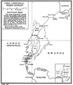
- Burundi-DRC border.png 842 × 1,140; 282 KB
- C hemistiktos map.png 3,200 × 1,800; 366 KB
- Carte de l'île de Noirmoutier par André Commard de Puylorson.jpg 2,500 × 3,624; 2.18 MB
- Carte Grishaverse Leigh Bardugo.jpg 800 × 600; 114 KB
- Carte Grishaverse.jpg 600 × 800; 108 KB
- Carte viols et agression 01.pdf 1,239 × 1,752; 219 KB
- Chapaev-JaksyAKmkz.png 289 × 530; 44 KB
- Ciudad jardin final.jpg 518 × 646; 105 KB
- ClevelandParliamentaryConstituency2021Results.png 1,280 × 879; 85 KB
- Cooch Behar subdivision demarcation.png 927 × 498; 545 KB
- Corregimientos municipio de Pereira.png 3,507 × 2,480; 4.12 MB
- Costa Rica-Nicaragua border.png 1,448 × 1,060; 137 KB
- Cricket West Indies members and affiliates.svg 3,808 × 2,647; 3.34 MB
- Denmark-Germany border.png 974 × 1,230; 167 KB
- Derby-mine-highland-pines-thumb-butte-prescott.jpg 2,626 × 1,582; 3.66 MB
- Deutschlandkarte-IHK 220118.png 848 × 1,200; 209 KB
- Diagram Showing Allotments of Land on Bad River Reservation - NARA - 84786026.jpg 15,576 × 12,352; 9.74 MB
- Djibouti-Somalia border.jpg 797 × 1,042; 95 KB
- Douarnenez fin XVIIIème siècle(Gallica Archives Nationales).jpg 1,376 × 1,381; 1.69 MB
- DRC-Rwanda border.png 835 × 962; 280 KB
- Découpage administratif du Guidimakha.jpg 599 × 715; 106 KB
- Eleccíon de gobernador de Puebla, 2019.svg 5,072 × 6,922; 53 KB
- Eltzegintza jarguera egon diren Euskal Herriko mapa.png 1,303 × 903; 90 KB
- Essuatíni.png 704 × 630; 92 KB
- Ethnic map of Turkey.png 1,920 × 938; 524 KB
- Européennes2019.png 6,396 × 6,095; 11.08 MB
- February 1, 1990 High Risk.png 1,200 × 675; 230 KB
- Fictional 1960 Presidential Results.svg 990 × 585; 40 KB
- Fort Miro or Post of Ouachita on the Ouachita River.jpg 2,967 × 3,955; 1.14 MB
- France-Italy border 2.jpg 2,130 × 2,867; 1.35 MB
- France-Italy border.jpg 1,967 × 2,789; 523 KB
- FutsalWCMap.png 4,500 × 2,234; 902 KB
- Gop primary mock gov 2012.png 600 × 329; 73 KB
- Guyana-Venezuela border.jpg 988 × 713; 159 KB
- Hakone Ekiden Course Map en.jpg 3,072 × 2,304; 842 KB
- Hakone Ekiden Course Map jp.jpg 3,072 × 2,304; 865 KB
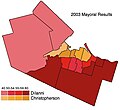
- Hamilton2003Mayoral.jpg 453 × 414; 42 KB
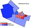
- Hamilton2006Mayoral.jpg 453 × 414; 43 KB
- Heatmap TAH 2 (3674759727).jpg 509 × 490; 286 KB
- Heatmap TAH 3 (3674760067).jpg 509 × 490; 242 KB
- Hilbert DImension visa policy.png 1,425 × 625; 42 KB
- Historic map of the World(GN01116).jpg 3,264 × 2,448; 1.64 MB
- Iran-USSR border.jpg 921 × 678; 177 KB
- Itinerario Benavente y Ourense 1845.jpg 357 × 360; 47 KB
- Jedermannslandmap.png 6,912 × 3,456; 1.57 MB
- Jordan-Saudi Arabia border.png 894 × 783; 241 KB
- July 20th, 1987 High Risk.png 1,200 × 675; 240 KB
- Karta taraclia 50x70sm.png 4,449 × 6,228; 9.38 MB
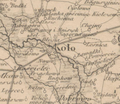
- Koło i okolice na mapie Karcie dawnej Polski.png 401 × 347; 244 KB
- Krakowska sieć tramwajowa.svg 1,825 × 1,125; 260 KB
- Lake Assal.png 741 × 768; 1.07 MB
- Latvaldialekti-uk.svg 810 × 544; 360 KB
- Linia 1.svg 1,825 × 1,125; 21 KB
- Linia 10.svg 1,825 × 1,125; 22 KB
- Linia 11.svg 1,825 × 1,125; 21 KB
- Linia 13.svg 1,825 × 1,125; 22 KB
- Linia 14.svg 1,825 × 1,125; 21 KB
- Linia 17.svg 1,825 × 1,125; 21 KB
- Linia 18.svg 1,825 × 1,125; 23 KB
- Linia 19.svg 1,825 × 1,125; 22 KB
- Linia 2.svg 1,825 × 1,125; 21 KB
- Linia 20.svg 1,825 × 1,125; 23 KB
- Linia 21.svg 1,825 × 1,125; 22 KB
- Linia 22.svg 1,825 × 1,125; 23 KB
- Linia 24.svg 1,825 × 1,125; 22 KB
- Linia 3.svg 1,825 × 1,125; 22 KB
- Linia 4.svg 1,825 × 1,125; 21 KB
- Linia 49.svg 1,825 × 1,125; 23 KB
- Linia 5.svg 1,825 × 1,125; 22 KB
- Linia 50.svg 1,825 × 1,125; 23 KB
- Linia 52.svg 1,825 × 1,125; 23 KB
- Linia 6.svg 1,825 × 1,125; 22 KB
- Linia 62.svg 1,825 × 1,125; 24 KB
- Linia 64.svg 1,825 × 1,125; 23 KB
- Linia 69.svg 1,825 × 1,125; 24 KB
- Linia 8.svg 1,825 × 1,125; 22 KB
- Linia 9.svg 1,825 × 1,125; 22 KB
- Liteiros.png 656 × 657; 266 KB
- Macau Travel Alert.svg 2,754 × 1,398; 1.15 MB
- Macedonia 1944 bg.png 320 × 449; 48 KB
- Macedonia 1944 en2.png 320 × 449; 55 KB
- Macedonian population in north-west Aegean Macedonia.png 2,632 × 2,240; 294 KB
- Malawi-Zambia border.png 839 × 1,118; 319 KB
- Map of Etruria.png 483 × 631; 162 KB
- Map of Venetian Dalmatian detail.png 1,260 × 715; 340 KB
- Map result Miss Grand International 2020.jpg 828 × 562; 99 KB
- Map Silberbergwerk Bromriesen.jpeg 4,032 × 3,024; 4.34 MB
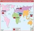
- Map-Francophonie organisation 2008.png 1,425 × 625; 46 KB
- Mapa da Região Metropolitana de Belém e área de inlufência.jpg 1,755 × 1,241; 1.08 MB
- Mapa de distribuição.png 840 × 589; 618 KB
- Mapa de la ciudad de Roma, siglo XVI.jpg 703 × 519; 73 KB
- Mapa de la diáspora venezolana en el mundo.png 1,280 × 663; 258 KB
- Mapa de la provincia del choapa.png 554 × 728; 626 KB
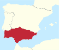
- Mapa de la República Federal d’Andalusia.svg 1,184 × 1,016; 450 KB
- Mapa De Las Cercanias De Mexico - DPLA - b6d60ea3533d18a0e1e063b278281433.jpg 7,251 × 5,933; 3.95 MB
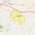
- Mapa de Pueblo Nuevo.png 593 × 629; 30 KB
- Mapa de rutas rodovias argentinas (Argentina road map) 2007-2008 (2746302806).jpg 2,527 × 2,522; 2.11 MB
- Mapa del ferro carril Mexicano y ramales de Puebla y Jalapa LCCN2005691825.jpg 5,073 × 4,148; 2.59 MB
- Mapa Digital de São José do Rio Preto.png 448 × 493; 637 KB
- Mapa dos Municípios de Tapajós.jpg 2,025 × 1,420; 688 KB
- Mapa Electoral de Honduras por municipios 2005.png 1,311 × 878; 76 KB
- Mapa histórico de América del Sur (1912) (3386187586).jpg 2,544 × 2,359; 1.37 MB
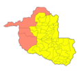
- Mapa por município da Eleição.png 726 × 649; 197 KB
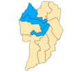
- Mapa por zona eleitoral em Curitiba em 1996.png 600 × 525; 66 KB
- Mapa1.jpg.opt522x424o0,0s522x424.jpg 522 × 424; 52 KB
- MapaElCarmenDeViboral1939.jpg 5,664 × 5,602; 15.48 MB
- Mapanoestadodebaden.png 257 × 290; 178 KB
- March 22, 1987 High Risk.png 1,200 × 675; 230 KB
- March 22, 1991 High Risk.png 1,200 × 675; 239 KB
- March 24th, 1988 High Risk.png 1,200 × 675; 217 KB
- March 27, 1991 High Risk.png 1,200 × 675; 241 KB
- March 28, 1991 High Risk.png 1,200 × 675; 233 KB
- March 29th, 1991 High Risk.png 1,200 × 675; 231 KB
- March 5th, 1989 High Risk.png 1,200 × 675; 213 KB
- May 15, 1990 High Risk.png 1,200 × 675; 243 KB
- May 17th, 1989 High Risk.png 1,200 × 675; 216 KB
- May 20, 1990 High Risk.png 1,200 × 675; 251 KB
- May 29, 1990 High Risk.png 1,200 × 675; 238 KB
- MD Table Rock 20191125 TM geo.pdf 3,600 × 4,350; 52.99 MB
- Menapii+ legende WIKI.png 3,747 × 3,415; 3.13 MB
- Microrregiao de colider.png 841 × 593; 341 KB
- MIO MIO mapa wroclaw 650+150 lokale okolo cut - tytul.jpg 685 × 610; 27 KB
- MIO MIO mapa wroclaw 650+150 lokale okolo cut.jpg 1,035 × 759; 654 KB
- Missgrandinternational2019 result.jpg 756 × 531; 102 KB
- Molva macrophthalma dis.png 395 × 189; 13 KB
- Monaghan county town map.png 534 × 486; 82 KB
- Montana Hypothetical 2022 Congressional Result.png 1,310 × 734; 151 KB
- Moulin de Caïpha cadastre 1833.jpg 1,787 × 1,190; 450 KB
- Moulin à vent cadastre 1833.jpg 2,191 × 1,268; 580 KB
- Mozambique-Zimbabwe border.png 828 × 1,160; 367 KB
- MunfordVicinity1900a.jpg 1,135 × 819; 312 KB
- Muslim countries Trade.jpg 1,280 × 960; 1.02 MB
- Namibia-Zambia border.png 840 × 1,164; 250 KB
- Netfinancial.png 1,714 × 763; 316 KB
- Northern Ethiopia Region.png 1,843 × 1,494; 524 KB
- November 15th, 1988 High Risk.png 1,200 × 675; 233 KB
- November 16th, 1987 High Risk.png 1,200 × 675; 227 KB
- November 4th, 1988 High Risk.png 1,200 × 675; 234 KB
- P 1125--Adventure mag 1911 Oct--Woman with the Wolves, map.png 781 × 1,081; 97 KB
- Pace I-90 Map.png 1,550 × 735; 255 KB
- Pak eez ex.jpg 800 × 480; 68 KB
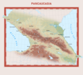
- Pancaucasia Map.png 2,893 × 2,639; 2.58 MB
- Paturi oculte-front.MARE.jpg 1,308 × 2,012; 985 KB
- Peta Mekarmukti.jpg 971 × 1,296; 278 KB
- Plano de Ostende, Argentina (1914).jpg 2,528 × 4,609; 5.14 MB
- Politička mapa Republike Gilead.jpg 3,840 × 2,375; 2.34 MB
- PrimaryResults96.png 600 × 376; 154 KB
- Purplebricks Revenue 2019.png 1,442 × 996; 491 KB
- Puzi, Taoyuan District.png 940 × 850; 66 KB
- Railroad Valley Mineral Resources Map.png 1,905 × 1,611; 997 KB
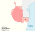
- Região de Rabat-Salé-Kénitra , Kénitra (província).png 199 × 247; 4 KB
- Região de Rabat-Salé-Kénitra , prefeitura de Rabat.png 199 × 247; 4 KB
- Região de Rabat-Salé-Kénitra , prefeitura de Salé.png 199 × 247; 4 KB
- Região de Rabat-Salé-Kénitra , prefeitura de Skhirate-Témara.png 199 × 247; 4 KB
- Regmetfor.png 683 × 729; 105 KB
- Result map Missgrandinternational2019.jpg 828 × 582; 95 KB


.jpg/120px-6._Kirby_Camp_(Middle).jpg)
.jpg/120px-6._Kirby_Camp_(Upper).jpg)






_(2147910462).jpg/80px-CARRETERA_AUSTRAL_mapa_del_sur_de_la_Región_de_Aysén%2C_Chile_(let´s_begin_this_debate_-_see_text_bellow)_(2147910462).jpg)



.pdf/page1-120px-Catoctin_Mountain_Park_CLI_-_Existing_Conditions_Site_Plan-_Map_A_(2af50f85-351d-43f8-a097-9402bc03422d).pdf.jpg)
.pdf/page1-120px-Catoctin_Mountain_Park-_Existing_Conditions_Site_Plan%2C_2014_(607696df-82e5-4598-a201-43fb7a4d8791).pdf.jpg)


.jpg/120px-Douarnenez_fin_XVIIIème_siècle(Gallica_Archives_Nationales).jpg)





.jpg/120px-Heatmap_TAH_2_(3674759727).jpg)
.jpg/120px-Heatmap_TAH_3_(3674760067).jpg)

.jpg/120px-Historic_map_of_the_World(GN01116).jpg)


_-_Josephinische_Landesaufnahme.jpg/120px-Kosowa_Kozowa_Galizien_und_Lodomerien_(1779–1783)_-_Josephinische_Landesaufnahme.jpg)






_2007-2008_(2746302806).jpg/120px-Mapa_de_rutas_rodovias_argentinas_(Argentina_road_map)_2007-2008_(2746302806).jpg)


_dos_anos_de_2000_e_2012.png/120px-Mapa_eleitoral_da_cidade_de_Itapetininga_(SP)_dos_anos_de_2000_e_2012.png)
_(3386187586).jpg/120px-Mapa_histórico_de_América_del_Sur_(1912)_(3386187586).jpg)




.jpg/66px-Plano_de_Ostende%2C_Argentina_(1914).jpg)


.png/97px-Região_de_Rabat-Salé-Kénitra_%2C_Kénitra_(província).png)


