Commons:Graphic Lab/Map workshop
| Illustration Workshop | Map Workshop | Photography Workshop | Video and Sound Workshop |
 Map workshop
This workshop is part of the Graphics Lab, a project aimed at picture retouching to improve the graphical content of the Wikimedia projects. More information about the lab can be found on its main page and requests pages (Illustrations ; Photographs ; Maps ; Video and Sound). To ask questions or make a suggestions, see the talk page of the graphic lab page.
This specific page is the requests page for the Map Workshop. Anyone can make a request for a map to be created or improved. The standard format for making a request is shown below, along with general advice, and should be followed.
Make a request
Use the following template when making a new request, replacing the examples with your image(s) and request(s):
<gallery>
 IMAGENAME.EXT|Description of image
 IMAGE#TWO.EXT|2nd image (If there is one)
 ETCETCETC.EXT|Don't request too many at once, though
</gallery>

;Request:
: Details of your request go here… --~~~~
;Graphist opinion(s):
See also[edit]
| SpBot archives all sections tagged with {{Section resolved|1=~~~~}} after 7 days and sections whose most recent comment is older than 185 days. For the archive overview, see /Archive. The latest archive is located at /Archive/2022. |
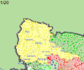
Blank svg map of districts of Turkey[edit]
- IMAGE1.EXT
File:Turkey districts blank.svg
Article(s): en:Turkey_districts_blank.svg
- Request
- A blank svg map of Turkey on district level (similar to the [1]). The only district map of Turkey on Wikipedia is this[2], which is a png map.
- There is a SVG map of Turkey‘s provinces here: https://commons.wikimedia.org/wiki/File:SVG_map_centered_on_Turkey,_showing_her_provinces.svg It needs to be edited, but it’s complete and accurate, as far as I can judge it.
Balkanique (talk) 18:43, 9 October 2021 (UTC)
- Graphist opinion(s)
Afrin offensive (January–March 2018)[edit]
Turkish military advancement in Afrin

Article(s): هجوم عفرين (يناير–مارس 2018)
- Request
- Can you please create an Arabic version of this gif file. The translation is as follows:
- Rajo = راجو
- Maabatli = معبطلي
- Afrin = عفرين
- Azaz = أعزاز
- Tell Rifat = تل رفعت
- Sawran = صوران
- Deir Jamal = دير جمال
- Mare' = مارع
- Nubl = نُبُّل
- Jindires = جنديرس
- Aleppo = حلب
- Darat Izza = دارة عزَّة
- Jalameh / Celemê = جلمة
- Qah = قاح
- Atmeh = أطمة
- Meidan Ekbis = ميدان أكبس
Thank you--باسم (talk) 20:30, 16 April 2021 (UTC)
- Graphist opinion(s)
باسم In that GIF there are 61 layers which each one containing those names with a changing background. So first you have to remove all of those names on all layers and restore the background. Then you have to add the translations. This is really really really a lot of work and the quality of image is not very good. So I'm not sure any one think it would be worth it. This is my reflection and I wanted you to know in case no one picks this request. --always ping me--Goran tek-en (talk) 12:48, 26 April 2021 (UTC)
- @Goran tek-en: thank you for clarifying this. If nobody was able to translate it then you can archive this request--باسم (talk) 17:24, 26 April 2021 (UTC)
- باسم I didn't say that, I only speak for myself. You can leave it open and see if someone picks it. --always ping me--Goran tek-en (talk) 18:18, 26 April 2021 (UTC)
- @باسم and Goran tek-en: hi, perhaps Pinging @Nate Hooper, the original uploader, can be of any help? En rouge (talk) 12:55, 6 August 2021 (UTC)
- Sorry, I'm not sure how to do that. I made this by editing each day in ms paint, it was someone else who originally made the map, where each layer, including the "name layer" were separate. Nate Hooper (talk) 01:57, 18 August 2021 (UTC)
- @باسم and Goran tek-en: hi, perhaps Pinging @Nate Hooper, the original uploader, can be of any help? En rouge (talk) 12:55, 6 August 2021 (UTC)
- باسم I didn't say that, I only speak for myself. You can leave it open and see if someone picks it. --always ping me--Goran tek-en (talk) 18:18, 26 April 2021 (UTC)
British territorial waters (Exclusive Economic Zone)[edit]
Current .svg map of the British EEZ
_in_the_World_(+Antarctica_claims).svg/120px-United_Kingdom_(+overseas_territories_and_crown_dependencies)_in_the_World_(+Antarctica_claims).svg.png)
Another .svg version

Another .png version

_in_the_World_(+Antarctica_claims).svg)

Article(s): potentially global usage; could supplant any of the maps above. Especially desirable for pages like British territorial waters and British overseas territories
- Request
- I'd like to request a more detailed world map of the British territorial waters and the territorial waters of the British overseas territories. The present maps don't have any labels and are quite small. It would be ideal if the territories themselves could be made (more) visible using a higher quality standard map. It would be really nice if there's a map for this purpose that shows the depth of the ocean as a relief map, and which has lines of latitude marked (to give an idea of the climate and environment). The territorial waters can be seen here: marineregions.org. My preference would be for a full-length Mercator projection (minimally cut off at the poles, to show the whole Antarctic territory and also because of the explicitly nautical purpose). Possibly there could be shading on the areas that are "territorial waters" and "contiguous zones", and the labels would be easily international-izable. Some of these are also "Marine Protected Areas" which could be useful information to incorporate, but not at all essential. I think this should probably be a relatively simple task for someone proficient in the usual cartographic software. Let me know if any more information is necessary; I look forward to seeing wikigraphists in action! GPinkerton (talk) 23:34, 23 June 2021 (UTC)
- Graphist opinion(s)
| Extended content |
|---|
|
GPinkerton I haven't got any answer yet and it might be it's not an active web page any more. So could you consider any format that is available to us as above? If not I will have to withdraw my "take" and you will have to find someone else with the necessary skills and software. --always ping me-- Goran tek-en (talk) 15:43, 21 August 2021 (UTC)
|
- Goran tek-en I think it will be easier for someone with map software skills to build a new map using the data than for you to do this by hand, yes. That way a basic world map could be made on which to base maps on many countries' maritime claims, protected areas, etc. Thanks for volunteering! GPinkerton (talk) 16:30, 21 August 2021 (UTC)
Need a correction on a map[edit]
Article(s): File:HotspotHighway.jpg
- Request
- Raratonga should be Rarotonga and Rurutu should be Arago.
- Per en:Arago hotspot that is nowadays the more common term, it seems. The Raratonga thing is just a plain typo fix. --Jo-Jo Eumerus (talk) 08:52, 5 July 2021 (UTC)
- Graphist opinion(s)
- Pinging @Scooteristi:
- - Jo-Jo Eumerus, perhaps the initial uploader can be of any help. Moreover, Scooteristi can upload an .svg version of the file? En rouge (talk) 13:03, 6 August 2021 (UTC)
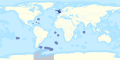
IKEA Map request[edit]

Map of current and future IKEA loctions
- IMAGE2.EXT
Description of second image (if needed)
- IMAGE3.EXT
Description of third image (if needed; don't request too many at once, though)

Article(s): List of countries with IKEA stores
- Request
- Update the map
- File:Map of IKEA stores.svg
Please update the map to include Ukraine, Mexico, and Slovenia in blue as they have opened IKEA stores as well as as add the Philippines, Chile, Brazil, Colombia, Peru, Luxembourg, New Zealand, Vietnam and Pakistan in yellow for future markets.- --Thenabster126 (talk) 01:05, 1 August 2021 (UTC)
- Graphist opinion(s)
![]() Done - Nancystodd (talk) 00:57, 19 August 2021 (UTC)
Done - Nancystodd (talk) 00:57, 19 August 2021 (UTC)
Former administrative units of Pakistan[edit]

the whole map
_(claims_hatched).svg/120px-Islamabad_Capital_Territory_in_Pakistan_(special_marker)_(claims_hatched).svg.png)
suggested style

_(claims_hatched).svg)
Article(s): en:Former administrative units of Pakistan
- Request
- Please vectorize the whole map of Pakistan and to select on her one by one administrative unit (red or dark green).
units are:
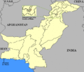
w:Phulra very small

w:Amb (princely state) very small
- No map, farthest north
- No map, west of the amb and east of swat
- No map, northwest of Hazara

w:Baltistan district farthest east
- No map, south of Nagar
- No map, south of Markan
Gwadar Enclave (purchased from Sultanate of Oman in 1958)


_map.gif)
_map.gif)


.svg)
.svg)
- Details of your request go here… --213.192.68.53 13:03, 1 August 2021 (UTC)
- Graphist opinion(s)
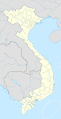
Hanoi location map.svg[edit]

Location map of Hanoi, Vietnam

Article(s): vi:Bản mẫu:Vị trí các di tích quốc gia đặc biệt tại Việt Nam
- Request
- Svg map editors needed
- Hi all! This svg map coordinates seemed to be incorrect. Can anyone please fix it? Thanks a lot! Hari caaru (talk) 00:54, 11 August 2021 (UTC)
- Graphist opinion(s)
-
- A bit difficult with only boundaries and no rivers but I would take
- N: 21.427139
- W: 105.154942
- S: 20.523778
- E: 106.132608
- Regards, NNW 16:40, 12 August 2021 (UTC)
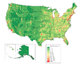
Covid-19 Vaccination Map of UK.png[edit]

Existing map by home nation only, showing April's data

Article(s): w:COVID-19 vaccination in the United Kingdom & its equivalents
- Request
- New map of COVID-19 vaccination in the United Kingdom
- Make a new map of covid-19 vaccinations in the UK by local authority area, rather than by home nation only, and with updated data (https://coronavirus.data.gov.uk/details/vaccinations here). The current map is now months old and doesn't show more than four data points. The new map ought to look something like the ones on the British Government websites: here, but with the metric of cumulative "People who have received 2nd dose vaccinations" from the government website rather than "percentage of adults vaccinated" used on the government's website interactive map. The data can be downloaded here. (The new map should use either the "Upper Tier Local Authority Data" (minimum detail) or the "Lower Tier Local Authority Data"; the "Middle layer Super Output Areas" (!) are probably unnecessarily small and the "regions" are unwieldy and have no administrative functions.) I assume an SVG file would be best for the purpose. GPinkerton (talk) 22:45, 12 August 2021 (UTC)
- Graphist opinion(s)
Population density maps of USA and of Europe using the same legend[edit]
Population density map of USA (precision=county)

Population density map of EU (precision=state/province/department at least, the more detailed the better)
- IMAGE3.EXT
Population density map of EU and other European countries, the more countries included the better, the more detailed the better...


Article(s): w:Americas
- Request
- I just came across this hypothesis, that the population density of the New World, after centuries of exponential growth, is still far lower than that of the Old World, especially Europe. It would be nice to have maps that use the same colour legend, so that they can be compared directly.
- The maps linked are just examples, not necessary to follow.
- It would be really cool to have a series of these maps of other countries as well, like India, China, Japan, Bangladesh, Indonesia, Southeast Asia... all these highly populated areas.
- I tried to look for existing files but I cant find much.--RZuo (talk) 10:38, 26 August 2021 (UTC)
- Graphist opinion(s)
Highlight East timor[edit]
.svg/120px-Indonesia_1976-1998_(orthographic_projection).svg.png)
Indonesia in 1993 with east timor
Reference 2
.svg)

Article(s): New Order
- Request
- Please Highlight East Timor like New Zealand territories in the second image. Also change the color please.
- Graphist opinion(s)
SVG blank maps of the world centered in Asia[edit]

Robinson projection centered in 162E
.svg/120px-World_location_map_(W3_Pacific).svg.png)
Winkel-Tripel projection centered in 150E
.svg)
Article(s): Various locator maps
- Request
- Hello, I have seen that we do not have any SVG maps centered on Asia in the Robinson and Winkel-Tripel projections, and I consider them necessary (preferably centered on the 90E meridian) to change the view for the locator maps for countries in the Far East, that look very strange such as this example here. The idea is to have them with the colors shown above (gray for Robinson and yellow-blue for Winkel) and preferably centered on the 90E meridian. Thank you. --Milenioscuro (talk) 18:21, 6 September 2021 (UTC)
- Graphist opinion(s)
1984 Summer Olympics medal map.png[edit]

World map from 1985

Participating nations during the 1984 Summer Olympics

2012 Summer Olympics medal map

New map


Article(s): en:1984 Summer Olympics medal table
- Request
- I would like a colored map to be created showing medal results for each nation during the 1984 Summer Olympic using the blank map from 1985 as seen in the first image. The second image is a reference guide to the nations that did participates in the 1984 Summer Olympics. I also posted an example from the 2012 Summer Olympics showing medals results with countries in gold (for nations that won at least one gold medal), silver (nations that won at least one silver medal, but no gold medals), bronze (nations that ONLY won at least one bronze medal), blue (nations that won zero medals), and red (nations that did not participate in that year's Olympics). --Birdienest81 (talk) 11:16, 29 September 2021 (UTC)
- Graphist opinion(s)
- @Birdienest81: that blank map is configured for hand-coding with a text editor, and by the time I’d finished experimenting with it I had your map half done. But I have a couple of quibbles about the 2012 example. One is that colouring non-participants in red seems to draw more attention to them than to the medal achievements, counter to the ostensible purpose; I would like to colour them dark grey. Another is that IMO the circle-markers for small islands and other countries or quasi-colonies just create visual clutter unless they were participants. Who would have guessed the Vatican didn’t send a team? So my preference would be to show the dots for the BVI and Singapore, for example, but not those for the Channel Islands or Brunei. (Rather than basing participation on the 1984 example above I would go by the list at en:1984 Summer Olympics#Participating National Olympic Committees.) What are your thoughts?—Odysseus1479 (talk) 03:05, 23 October 2021 (UTC)
- @Odysseus1479: I think coloring the non-participating nations with dark grey is perfectly fine. Your suggestion on basing the participation of each nation by the aforementioned list you've mentioned works for me. You're free to make the map as how you see fit.
- --Birdienest81 (talk) 08:07, 26 October 2021 (UTC)
- @Odysseus1479: I think coloring the non-participating nations with dark grey is perfectly fine. Your suggestion on basing the participation of each nation by the aforementioned list you've mentioned works for me. You're free to make the map as how you see fit.
![]() Done. @Birdienest81: please check it over and let me know if there are any problems. I grouped non-participant colonies &c. with their parent countries, so for example Greenland is silver and St-Pierre-et-Miquelon is gold.—Odysseus1479 (talk) 08:36, 2 November 2021 (UTC)
Done. @Birdienest81: please check it over and let me know if there are any problems. I grouped non-participant colonies &c. with their parent countries, so for example Greenland is silver and St-Pierre-et-Miquelon is gold.—Odysseus1479 (talk) 08:36, 2 November 2021 (UTC)
- @Odysseus1479: Looks good. I wonder though if you could crop out the Antarctica continent and/or the outer board representing the shape of the globe so that it does look like the 2012 map. Otherwise, I placed the map onto the 1984 Summer Olympics medal table. Great work.
- --Birdienest81 (talk) 10:26, 2 November 2021 (UTC)
- @Birdienest81: I had the same idea earlier, and tried to crop it by hacking the code but got, shall we say, unexpected results. (Making the ocean & Antarctica disappear is easy; it’s getting rid of the extra space that I’m finding hard.) I might be able to figure out the coördinates with some more experimenting, though. It would be simple to crop in a graphic editor, but I’d rather leave that as a last resort because it will lose the CSS-editability. (Then again, the original would still be available from the file history.)—Odysseus1479 (talk) 03:24, 3 November 2021 (UTC) P.S. Never mind, figured it out,
 Done.—05:06, 3 November 2021 (UTC)
- @Odysseus1479: Looks good. I wonder though if you could crop out the Antarctica continent and/or the outer board representing the shape of the globe so that it does look like the 2012 map. Otherwise, I placed the map onto the 1984 Summer Olympics medal table. Great work.
Locator map of Kurdistan[edit]

Kurdish inhabited areas

Article: e.g. Kurds, Kurdistan
- Request
- Adapt Map 0.2 from The Cambridge History of the Kurds
- Make a standard grey-green location map for the same area as is marked on Map 0.2 on page xxviii of The Cambridge History of the Kurds (Bozarslan, Gunes, & Yadirgi, 2021). The "Map of Kurdish inhabited areas" should be laid over the typical grey-green orthographic projection centred on, say, Jazirat ibn ʿUmar (Turkish: Cizre). Versions with and without international borders would both be useful. GPinkerton (talk) 20:54, 5 October 2021 (UTC)
- Graphist opinion(s)
| Extended content |
|---|
This is important as it gives me information on how I/we can use it. --please ping me-- Goran tek-en (talk) 15:21, 21 October 2021 (UTC)
@GPinkerton: I really would need to know if you want me to withdraw my take so someone else can work on this, thanks. --please ping me-- Goran tek-en (talk) 19:08, 1 November 2021 (UTC)
|
- Hi @GPinkerton: , what you are requesting is really complex. Orthographic maps are generated using existing shapefiles (the format to encode geographical locations).
Converting an image into a shapefile is quite complex. You could do it using QGIS, but it's not a simple task. to be honest I haven't seen other historical maps represented with orthogonal projection. Sette-quattro (talk) 12:40, 29 November 2021 (UTC)
- Hi @GPinkerton: , i've done it. It has been a really complex task but I learnt lots of stuff. All the metadata must be added. Let me know what do you think and in case mark it as done Sette-quattro (talk) 18:35, 16 December 2021 (UTC)
- @Sette-quattro: Hi thanks so much for doing this! I'm very impressed. Would it be possible to make a version without the white political borders? Additionally, it would also be great to have a flat map of the same area (did you make a new shapefile for the highlighted areas?) such a map would be good to have for the making the details of the region more visible. GPinkerton (talk) 01:55, 11 January 2022 (UTC)
- Sure, as soon as I have time. I don't know if there are established practices on how to share on commons shapefiles, i'd like to do so. I can upload a newer version without political boundaries.
- I can also produce a mercator projection (flat map) of the area. should I add or not political boundaries?
- Best --Sette-quattro (talk) 08:35, 11 January 2022 (UTC)
- @Sette-quattro: Political boundaries would be most useful, though a version without could also be helpful. If the borders are shown, then it would be good if they went over the top of the green area, so as to still be visible there. GPinkerton (talk) 16:48, 11 January 2022 (UTC)
- @Sette-quattro: Hi thanks so much for doing this! I'm very impressed. Would it be possible to make a version without the white political borders? Additionally, it would also be great to have a flat map of the same area (did you make a new shapefile for the highlighted areas?) such a map would be good to have for the making the details of the region more visible. GPinkerton (talk) 01:55, 11 January 2022 (UTC)
- Hi @GPinkerton: , i've done it. It has been a really complex task but I learnt lots of stuff. All the metadata must be added. Let me know what do you think and in case mark it as done Sette-quattro (talk) 18:35, 16 December 2021 (UTC)
Request of SVG location map of South Vietnam (1955-1975)[edit]
SVG location map of Vietnam

Source map


.png/61px-Location_map_of_Vietnam_(South_Vietnamese_claim).png)
map approximation


.png)
Article(s): en:South Vietnam, vi:Việt Nam Cộng hoà, vi:Tỉnh (Việt Nam Cộng hoà),...
- Request
- Why don’t you vectorize a SVG location map of South Vietnam (1955-1975) --Baokhang48812002 (talk) 01:44, 13 October 2021 (UTC)
- Graphist opinion(s)
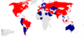
United Nations regional groups[edit]

Map of countries by UN regional group

Article(s): en:United Nations Regional Groups
- Request
- The United States is not formally a member of the Western Europe and Others Group (WEOG). Rather, they are an observer and are counted alongside WEOG solely for electoral purposes. (This is a unique case; no other UN member state holds observer status in a regional group.) Given that this map is used on the English and French Wikipedias (and I presume elsewhere) to display group membership, not merely who is counted how for electoral purposes, could the United States be given a lighter shade of that gold-ish colour to reflect that they are an observer? Thanks, 207.161.86.162 03:11, 22 October 2021 (UTC)
- Graphist opinion(s)
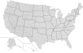
Location Maps of Mid-Atlantic and Northeast United States[edit]

Existing map of the northeast United States

Existing map of the Mid-Atlantic United States
.svg/120px-USA_Northeast_(cropped).svg.png)
Cropped version of first map

Cropped (to Midatlantic states) version of the first map

Mid-Atlantic states (WGS84)

Northeastearn states (WGS84)


.svg)


Article(s): Various
- Request
- The existing location maps of the Mid-Atlantic and Northeast United States cover an area much more broad than what is usually considered part of both of those two areas. (see [3] and [4] for reference) This means that it is more likely that location maps that have multiple marks will be difficult to read due to overlap. (Yes, I know that a magnified version wouldn't solve all of the problems in this example, but it would still be useful more broadly.) Therefore, a version of the Northeast map above showing only roughly the area from central Ohio east and northern Virginia north and a version of the Mid-Atlantic map above showing only the area from eastern Massachusetts west, northern North Carolina north, and the Canadian border south would be helpful. –Noha307 (talk) 01:16, 25 October 2021 (UTC)
- Graphist opinion(s)
![]() Done Both. I didn't use the second, because it's a PNG, but the first was useable for both. MjolnirPants (talk) 15:25, 1 November 2021 (UTC)
Done Both. I didn't use the second, because it's a PNG, but the first was useable for both. MjolnirPants (talk) 15:25, 1 November 2021 (UTC)
- MPants at work, The map for Mid-Atlantic States has clipped Long Island from NYS. I recommend extending the right boundary to include that. Also, it would be helpful to get the extent in lat/long for each so they be can used in a {{Location}} template. Thanks for taking on Noha307 's request. - DutchTreat (talk) 10:30, 9 November 2021 (UTC)
- I've added back in Long Island. As for the geo coordinates, those are not embedded in the files, and not formally defined as far as I'm aware. I just looked at it in Google Earth and the mid-Atlantic region is roughly bound at [46.567394,-82.145506],[35.161925,-71.515667]. You can get the coordinates for the first map the same way (the current coordinates of the cursor are shown at the bottom right of the Google Earth viewport pane). MjolnirPants (talk) 13:40, 9 November 2021 (UTC)
- MPants at work Yes, thanks for doing this. I appreciate it.
- DutchTreat I considered doing the work myself, but not knowing how to add the location map functionality was one of the things that stopped me. (Another is my limited skill with vector editing programs.) After a bit of looking around, I came across an explanation of the process, so I'll try to take a whack at it when I get a chance. I might be able to add the {{Location}} template you mentioned at the same time, but I'm not sure how this would work with an image depicting an area more broad than just a single point as the template does not appear to be designed for that capability. –Noha307 (talk) 06:00, 11 November 2021 (UTC)
- Noha307 No worries. I will help you turn these into locator maps. Due to my schedule, I'll need a few days to complete. - DutchTreat (talk) 10:29, 11 November 2021 (UTC)
- DutchTreat Thanks! I appreciate the help! I didn't want to leave all the work up to you, so I tried creating modules and documentation pages for the maps (1, 2) based off of the example the image file was based on and I think I got most of it correct. However, what I'm stuck on is that I don't know how to obtain the exact coordinates for the edges of the maps. I was able to get the sample pushpins in the documentation close based on guess and check by slightly adjusting them and then using the page preview, but I'm sure it's slightly off. The USA Northeast map also uses some sort of calculation I am not familiar with to correct for the distortion of the map projection. –Noha307 (talk) 22:09, 14 November 2021 (UTC)
- Noha307 Good start! I agree the issue is with the projection needs to correct for a different Coordinate Reference System (CRS). Let me have a look to see if I can fix it. - DutchTreat (talk) 12:55, 21 November 2021 (UTC)
- DutchTreat Did you have any luck correcting the coordinates for the location maps? –Noha307 (talk) 01:03, 7 December 2021 (UTC)
- Noha307 Good start! I agree the issue is with the projection needs to correct for a different Coordinate Reference System (CRS). Let me have a look to see if I can fix it. - DutchTreat (talk) 12:55, 21 November 2021 (UTC)
- DutchTreat Thanks! I appreciate the help! I didn't want to leave all the work up to you, so I tried creating modules and documentation pages for the maps (1, 2) based off of the example the image file was based on and I think I got most of it correct. However, what I'm stuck on is that I don't know how to obtain the exact coordinates for the edges of the maps. I was able to get the sample pushpins in the documentation close based on guess and check by slightly adjusting them and then using the page preview, but I'm sure it's slightly off. The USA Northeast map also uses some sort of calculation I am not familiar with to correct for the distortion of the map projection. –Noha307 (talk) 22:09, 14 November 2021 (UTC)
- Noha307 No worries. I will help you turn these into locator maps. Due to my schedule, I'll need a few days to complete. - DutchTreat (talk) 10:29, 11 November 2021 (UTC)
- I've added back in Long Island. As for the geo coordinates, those are not embedded in the files, and not formally defined as far as I'm aware. I just looked at it in Google Earth and the mid-Atlantic region is roughly bound at [46.567394,-82.145506],[35.161925,-71.515667]. You can get the coordinates for the first map the same way (the current coordinates of the cursor are shown at the bottom right of the Google Earth viewport pane). MjolnirPants (talk) 13:40, 9 November 2021 (UTC)
Noha307 - Sorry, no progress in learning how to do the CRS transform formulas. I looked the ones for wikipedia:Module:Location_map/data/USA and wikipedia:Module:Location_map/data/USA_Northeast. There appears to be a basic substitution needed, but I'm not sure what that should be. - DutchTreat (talk) 12:11, 8 December 2021 (UTC)
- DutchTreat No problem, thanks for trying anyway. –Noha307 (talk) 04:33, 14 December 2021 (UTC)
- @Noha307: I received some background info from User:Sting. I am now thinking it would be best for me to re-draw the map with a equirectangular projection. - DutchTreat (talk) 21:00, 14 December 2021 (UTC)
- @Noha307: Completed two maps using a equirectangular projection Mid-Atlantic states and Northeastearn states. I updated your mod w:Module:Location map/data/USA Mid-Atlantic. I noticed that Dmm1169 on 15 December a new mod w:Module:Location map/data/USA Northeastern. I started a discussion on the talk page to determine which map file to use there. - DutchTreat (talk) 13:30, 16 December 2021 (UTC)
- The file w:Module:Location map/data/USA Northeastern was created for the module. Creating the module is simpler using a Mercator projection map where the borders can be defined by a simple lat/long. It does include [[Mid-Atlantic states so I'd be ok if it's renamed USA Mid-Atlantic and Northeast if that's better.-Dmm1169 (talk) 15:38, 16 December 2021 (UTC)
- @Dmm1169: I agree that a projection that is equirectangular is preferred. I also support two modules: one for Northeast (zoomed in from the current larger one starting in the midwest) like you created and a second module for the middle Atlantic states. My comment was on the module for USA Northweastern. I prefer the SVG map file. Hope that helps clarify my position. - DutchTreat (talk) 14:03, 18 December 2021 (UTC)
- DutchTreat, Dmm1169: I appreciate the help guys. Since I understand that pushpin location maps are somewhat falling out of favor anyway, I was going to suggest just dropping the effort due to the complications. Thanks for continuing on.
- I feel like USA Northeast should be renamed – the similarity of the name to USA Northeastern is already confusing me. However, I can't think of a better name as there doesn't seem to be any generally accepted term for the region of the United States it depicts. Any ideas? (Sorry Dutch, I like SpongeBob as much as the next guy, but I don't think "USA Northweastern" is going to work as a title.) The best I can come up with is "Midwest and Northeast".
- Also, should w:Module:Location map/data/USA Northeast (cropped) be deleted? If it is left up I am afraid people might try to use it without knowing it won't display locations accurately. –Noha307 (talk) 20:30, 20 December 2021 (UTC)
- @Dmm1169: I agree that a projection that is equirectangular is preferred. I also support two modules: one for Northeast (zoomed in from the current larger one starting in the midwest) like you created and a second module for the middle Atlantic states. My comment was on the module for USA Northweastern. I prefer the SVG map file. Hope that helps clarify my position. - DutchTreat (talk) 14:03, 18 December 2021 (UTC)
- The file w:Module:Location map/data/USA Northeastern was created for the module. Creating the module is simpler using a Mercator projection map where the borders can be defined by a simple lat/long. It does include [[Mid-Atlantic states so I'd be ok if it's renamed USA Mid-Atlantic and Northeast if that's better.-Dmm1169 (talk) 15:38, 16 December 2021 (UTC)
- @Noha307: Completed two maps using a equirectangular projection Mid-Atlantic states and Northeastearn states. I updated your mod w:Module:Location map/data/USA Mid-Atlantic. I noticed that Dmm1169 on 15 December a new mod w:Module:Location map/data/USA Northeastern. I started a discussion on the talk page to determine which map file to use there. - DutchTreat (talk) 13:30, 16 December 2021 (UTC)
- @Noha307: I received some background info from User:Sting. I am now thinking it would be best for me to re-draw the map with a equirectangular projection. - DutchTreat (talk) 21:00, 14 December 2021 (UTC)
Maps of USA Northeast # Map Next steps 1 USA Northeast Rename - "USA Midwest and Northeast"
I like Noha307's proposal.2 USA Northeastern Update - swap image from "USA Northeastern.png" to "USA Northeast location map.svg".
The SVG map I created has the following advantages. (a) Uses color coding to clearly define which states are in the region. (b) It uses a scaleable SVG format. (c) Zoomed in to provide better definition.
I'll let community consensus drive the result, since I created this map.3 USA Northeast (cropped) Delete not used as of 2021-12-22.
This map is not needed. Could cause confusion.4 USA Mid-Atlantic No changes
Sorry about the typo for "Northweastern", but glad it provided some unintended humor! - DutchTreat (talk) 11:46, 22 December 2021 (UTC)
Ireland Border Maps[edit]
Image of the Map of Ireland
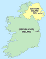
Political Map of Ireland (Please convert to SVG)

New SVG blank map with flags
.svg/96px-European_Union_internal_frontier_in_Ireland_(pre-Brexit).svg.png)
Additional pre-Brexit companion map


.svg)
Article(s): Various
- Request
- There’s no issue with the maps itself hence why it’s here but I just wondered if it was possible to add a flag of the UK in the Northern Ireland section and a Irish flag along with a EU flag for Southern Ireland in both of these maps to show that the Republic is a EU member given that the Irish Border is also now a EU frontier as well as the UK-border as currently this map only shows a border with nothing to indicate the current geo-political structure of the UK Irish border after Brexit. Also can the Political map be converted to SVG. Then these maps could be then used in other articles. (MOTORAL1987 (talk) 13:46, 28 October 2021 (UTC))
- Graphist opinion(s)
MOTORAL1987 I have made one SVG using an existing SVG map and added flags. It doesn't have labels, but they could be added if necessary, though I think the flags make it obvious enough. GPinkerton (talk) 17:04, 28 October 2021 (UTC)
- GPinkerton Thank you and sorry I haven’t replied until now this is a really good start and I do like it I think however labels should be added thou and also please can a flag of the Irish Republic also be added into the SVG and just maybe the flags should be made just slightly smaller otherwise it’s looking perfect. (MOTORAL1987 (talk) 12:22, 31 October 2021 (UTC))
- MOTORAL1987 I put the European flag only because I thought that was more relevant and because I didn't read the initial request properly (!) What labels are needed: country names (which? how many?, how abbreviated?), capital cities? Irish Sea? Great Britain? So far I left the labels out because that way it's universal and international; are they strictly necessary? GPinkerton (talk) 13:59, 31 October 2021 (UTC)
- Also, how should the two flags be arranged? Side by side, or one atop the other, or maybe with the Irish flag in the middle of the country and the European one closer the border? GPinkerton (talk) 14:05, 31 October 2021 (UTC)
- GPinkerton Thank you and sorry I haven’t replied until now this is a really good start and I do like it I think however labels should be added thou and also please can a flag of the Irish Republic also be added into the SVG and just maybe the flags should be made just slightly smaller otherwise it’s looking perfect. (MOTORAL1987 (talk) 12:22, 31 October 2021 (UTC))
I think the Irish and EU flags should be side by side in the centre of the map with the flags made slightly smaller so they are not overpowering to the map, oh don’t forget the labels I think Should be simply Northern Ireland with the UK in brackets under the UK flag and the Republic of Ireland with the EU in brackets in the southern section under the flags. Belfast and Dublin should also be in there with small labels and also the Irish Sea. Hope that makes sense. (MOTORAL1987 (talk) 14:17, 31 October 2021 (UTC))
- @MOTORAL1987: I have added labels and the Irish flag to the same file, although to tell the truth, I think the utility of the map is somewhat reduced thereby: the addition of labels makes the flags redundant, and the addition of flags makes the labels unnecessary, while the addition of either leads to the diminution of both (and hence to reduced readability overall). GPinkerton (talk) 15:52, 31 October 2021 (UTC)
- Can the flag sizes be slightly reduced slightly at all otherwise I think it’s generally perfect although I do think a thinker Irish border would also be welcome. Thanks so much (MOTORAL1987 (talk) 17:49, 31 October 2021 (UTC))
- @MOTORAL1987: I have reduced the flag sizes, though I have to say I think it's less attractive this way as the stripes and the stars are quite indistinct without putting the map in full screen. GPinkerton (talk) 18:38, 31 October 2021 (UTC)
- I also made a matching map that shows the pre-Brexit situation. GPinkerton (talk) 18:52, 31 October 2021 (UTC)
- @GPinkerton: Cheers I do think that works better thou, don’t worry I think it’s fine the last thing I think that just needs altering is underneath the Republic of Ireland can the text change from “(European Union) to (EU member state)” and could a third map be created which is the same as the other two but without any references to the EU please otherwise that is it. Thanks so much for doing that (MOTORAL1987 (talk) 19:44, 31 October 2021 (UTC))
- Can the flag sizes be slightly reduced slightly at all otherwise I think it’s generally perfect although I do think a thinker Irish border would also be welcome. Thanks so much (MOTORAL1987 (talk) 17:49, 31 October 2021 (UTC))
Mapa de la Ilha de Santo Aleixo[edit]
Holá, amigo. ¿Qué tal?
Soy edictor de Wikipédia y necesito de tu ayuda: ¿Podés actualizar los nombres del mapa de la Ilha de Santo Aleixo? (https://commons.wikimedia.org/wiki/File:Ilha_do_Aleixo.png)
Actualmente, el mapa no presenta los nombres de las dos playas: Praia dos Pernambucanos (Este) y Praia da Holanda (Sur), más allá de Enseada Espanha e França (Abajo de la playa ubicada en el Sur).
¡Muchas gracias, amigo!
¡Saludos!
Supermapp (talk) 19:52, 1 November 2021 (UTC)
List of metro systems[edit]

Article(s): en:List of metro systems
- Request
- Please put Serbia under yellow as the Belgrade Metro started construction… --2603:8081:1604:88DE:742F:4DEE:6D7E:9969 05:47, 23 November 2021 (UTC)
- Graphist opinion(s)
![]() Done – New image version uploaded. Rcsprinter123 (talk) 21:23, 24 November 2021 (UTC)
Done – New image version uploaded. Rcsprinter123 (talk) 21:23, 24 November 2021 (UTC)
Tagging for archiving, as the request seems to be fulfilled. --Donald Trung 『徵國單』 (No Fake News 💬) (WikiProject Numismatics 💴) (Articles 📚) 10:44, 29 January 2022 (UTC)
Map of IKEA stores[edit]
Description of first image
- IMAGE2.EXT
Description of second image (if needed)
- IMAGE3.EXT
Description of third image (if needed; don't request too many at once, though)
Article(s): en:List of countries with IKEA stores
- Request
- Please add Puerto Rico in blue as IKEA is there and add Peru and Oman in yellow as they plan on opening IKEA stores.--2603:8081:1604:88DE:F402:4466:D101:EA4D 07:06, 3 December 2021 (UTC)
- Graphist opinion(s)
1356 Poitiers campaign[edit]
- IMAGE1.EXT
Routes of the French and Anglo-Gascon armies through south-west France in 1356
- IMAGE2.EXT
Manoeuvres leading to the Battle of Poitiers
Article(s): en:Black Prince's chevauchée of 1356
- Request
- Two maps showing the movements of the French and Anglo-Gascon armies through south-west France in 1356 prior to the en:Battle of Poitiers. I will need to email through copies of the maps from my hard copy sources to whoever generously takes this on.
- Details
- The first map will be similar to File:Map of route of Black Prince chevauchée of 1355.svg or File:Map of the route of Edward III's chevauchée of 1346.svg. The second map will be simpler. Gog the Mild (talk) 22:19, 3 December 2021 (UTC)
- Graphist opinion(s)
Rewritten map of South American tectonics[edit]
Article(s): en:Pali-Aike volcanic field
- Request
- I need someone to alter this map in accordance with the request here. To be clear, the line that separates the Scotia and South American plate is the Magallanes-Fagnano fault. --Jo-Jo Eumerus (talk) 17:01, 16 December 2021 (UTC)
- Graphist opinion(s)
- Hi @Jo-Jo Eumerus: it's not really clear what should be changed, could you provide a coincise description since i think moust of us are not experts of tectonic plates? Furthermore, Thee only geographical source I found is this one (an you can find here it as geojson) which has more plates than the currnt image on commons. It's the only sourece I found. If you have other ones, they are welcome. Best --Sette-quattro (talk) 09:07, 3 January 2022 (UTC)
- Greetings, Sette-quattro. What I need is:
- Crop the map so that it covers only the lowermost part of South America.
- Label the squiggly line between the Nazca and Antarctic plate as "Chile Rise"
- Label the vertical line between the South America and Nazca plate as "Peru-Chile Trench"
- Label the horizontal line between the South America and Scotia plate - specifically the part in South America - as the "Magallanes-Fagnano and Deseado faults"
- Does this help?Jo-Jo Eumerus (talk) 13:20, 3 January 2022 (UTC)
- Greetings, Sette-quattro. What I need is:
Holocaust Denial Laws[edit]
Description of first image
- IMAGE2.EXT
Description of second image (if needed)
- IMAGE3.EXT
Description of third image (if needed; don't request too many at once, though)

Article(s): Legality of Holocaust denial
- Request
- Please add Bosnia & Herzegovina to the list as it recently criminalized all genocide denial. --2603:8081:1602:E41F:502B:1E46:3FC1:9898 20:15, 26 December 2021 (UTC)
- Graphist opinion(s)
Rivers in China[edit]


Article(s): zh:中华人民共和国最长河流列表
- Request
- Please help re-upload (as a new file) the historical version of this map without those river names (i.e., please help upload this version).
- The existing version labels those rivers with their historical names, therefore I cannot use them to talk about rivers in the modern China. --173.75.31.249 19:10, 27 December 2021 (UTC)
- Graphist opinion(s)
- I can do a new version starting from geograhpical data. Do you have a source (a shapefile, a geojson) for the rivers? --Sette-quattro (talk) 21:11, 29 December 2021 (UTC)
- Sorry I don’t … I am not the original author of the map. —173.75.31.249 00:07, 30 December 2021 (UTC)
- Done @173.75.31.249: let me know if it's fine. --Sette-quattro (talk) 19:43, 1 January 2022 (UTC)
- Woohoo! One small icing on the cake: the map currently includes all the natural rivers in China, perhaps w:en:Grand Canal (China) can be included as well? The map looks totally awesome on its own; major rivers & their locations are all accurate. Mentioning this only because you named it "Rivers in China" instead of "Natural Rivers in China". --173.75.31.249 06:08, 2 January 2022 (UTC)
- Hi, i did not found any geograhpical data (shapefile) of the grand canal. furthermore, i'm not sure if it's a good idea to mix different data sources, but this is a decundary issue. One thing that we could do is to label the rivers in different languages, or at least to number them, what do you think? --Sette-quattro (talk) 08:20, 3 January 2022 (UTC)
- Labeling rivers sounds like a good idea to me. We can certainly keep this blank version, and have new files with river labels in different languages built on top of it. Yet this sounds like a large commitment; I don't mean to burden you too much. Please let me know how I may help. -- 173.75.31.249 02:10, 4 January 2022 (UTC)
- Hi, i did not found any geograhpical data (shapefile) of the grand canal. furthermore, i'm not sure if it's a good idea to mix different data sources, but this is a decundary issue. One thing that we could do is to label the rivers in different languages, or at least to number them, what do you think? --Sette-quattro (talk) 08:20, 3 January 2022 (UTC)
- Woohoo! One small icing on the cake: the map currently includes all the natural rivers in China, perhaps w:en:Grand Canal (China) can be included as well? The map looks totally awesome on its own; major rivers & their locations are all accurate. Mentioning this only because you named it "Rivers in China" instead of "Natural Rivers in China". --173.75.31.249 06:08, 2 January 2022 (UTC)
- Sorry I don’t … I am not the original author of the map. —173.75.31.249 00:07, 30 December 2021 (UTC)
Wikipedia:Village pump (technical) discussion on SVG maps[edit]
Looking for additional knowledgeable people in this SVG map discussion:
--Timeshifter (talk) 03:09, 31 December 2021 (UTC)
Alaska changes to Usa counties large[edit]
Usa counties large.svg

Alaska boroughs and census areas 2019.svg


Article(s): en:Wikipedia:WikiProject National Register of Historic Places/Progress and other places that have maps derived from this one
- Request
- Update Usa counties large.svg to reflect recent changes in Alaskan subdivisions
- There have been changes to Alaska's subdivisions, the latest apparently in 2019 when Chugash and Copper River Census Areas were created out of the Valdez-Cordova Census area. There may be other older changes in Alaska not reflected in the current version of Usa counties large -- can the file be updated to reflect the state subdivisions depicted in File:Alaska boroughs and census areas 2019.svg, please? I plan to fold the resulting SVG changes into other maps. --Magic♪piano 16:13, 7 January 2022 (UTC)
- Graphist opinion(s)
- IMAGE1.EXT
Description of first image
- IMAGE2.EXT
Description of second image (if needed)
- IMAGE3.EXT
Description of third image (if needed; don't request too many at once, though)
Article(s): [[]]
- Request
- Details of your request go here… --Aaronthegreat1989 (talk) 07:51, 13 January 2022 (UTC)
- Graphist opinion(s)
File:Nilotic languages.png[edit]

Distribution of the Nilotic languages

- Request
- Please fix the colors on the map so that it is readable by people with red/green colorblindness, preferably by replacing the green with light gray. Please also add the boundary between Sudan and South Sudan, which is especially relevant on this map since the Nilotic languages are widespread in South Sudan but barely present in Sudan. Ideally, since it's a map, this PNG file should be replaced with an SVG file. Thanks! —Mahāgaja · talk 10:17, 13 January 2022 (UTC)
- Pinging @Davius: as the original creator of the map, although (s)he hasn't been around in several months. —Mahāgaja · talk 16:05, 13 January 2022 (UTC)
- Graphist opinion(s)
- @Mahagaja I've changed the colour scheme and added the border, as requested. I can try making an SVG map later, though as this has a different projection than that off most standardised maps, it may take some time. — Berrely • T∕C 20:08, 13 January 2022 (UTC)
map-request in illustration workshop[edit]
if anybody could help for this request in illustration workshop: COM:GL/I#Rail_transport_map_of_Turkey_maps
--Mrmw (talk) 10:37, 16 January 2022 (UTC)
Metro in the World[edit]
Description of first image
- IMAGE2.EXT
Description of second image (if needed)
- IMAGE3.EXT
Description of third image (if needed; don't request too many at once, though)

Article(s): List of metro systems
- Request
- Please make Serbia orange as the Belgrade Metro is under construction and Iraq brown as the Baghdad Metro is being planned. --2603:8081:1602:E41F:15D:3469:BE01:D274 08:42, 18 January 2022 (UTC)
- Graphist opinion(s)
![]() Done – Uploaded your changes. Rcsprinter123 (talk) 20:35, 19 January 2022 (UTC)
Done – Uploaded your changes. Rcsprinter123 (talk) 20:35, 19 January 2022 (UTC)
Tagging for archiving, as the request seems to be fulfilled. --Donald Trung 『徵國單』 (No Fake News 💬) (WikiProject Numismatics 💴) (Articles 📚) 10:43, 29 January 2022 (UTC)
Topographic map with contours highlighted[edit]
Article(s): en:Lake Estancia
- Request
- Is it possible to get a topographic map of the en:Lake Estancia basin with the 1897m ("late Estancia"), 1939m ("early Estancia") and 1870m ("Lake Willard") elevation contours highlighted and labelled? --Jo-Jo Eumerus (talk) 15:52, 22 January 2022 (UTC)
- Graphist opinion(s)
- Done File:Lake Estancia and Lake Willard.png --Guerillero 10:20, 26 January 2022 (UTC)
Map of the French protectorates of Annam and Tonkin in 1937[edit]
Overview of the request[edit]

A map of the first (1st) and second (2nd) level subdivisions of French Indo-China in the Gregorian year 1937.
.svg/85px-Nguyen_Dynasty%2C_administrative_divisions_map_(1838).svg.png)
Map of the Nguyễn Dynasty in 1838.

Additional map of French Indo-China, for reference.

Concept image of the map I want to have created.

.svg)


![[1]](https://commons.wikimedia.org/wiki/File:BlankMapTurkeyProvinces.png)
.svg)
.svg)
.svg)
.png)
.svg)
![[3]](https://en.wikipedia.org/wiki/File:The_Mid-Atlantic_States.png)
![[4]](https://en.wikipedia.org/wiki/File:Map_of_the_North_Eastern_United_States.svg)
Article(s): en:Nguyễn dynasty
- Request
I would like to request the creation of a map of the provinces of the Nguyễn Dynasty in 1937 based on the above maps. The French protectorate of Tonkin should be red while the French protectorate of Annam yellow to reflect the map of the Nguyễn Dynasty under the Minh Mạng Emperor above, the rest of French Indochina should be a very light shade of purple (or as transparent as possible) to indicate that Đại-Nam is a part of the Union of Indo-China but clear enough that the observer will see that the rest of French Indo-China is not a part of Đại-Nam.
The best way to do this is by using the map and code of "File:Nguyen Dynasty, administrative divisions map (1838).svg" as the base, use the administrative boundaries and names of "File:French Indochina 1937.png", and then use the general layout and colour scheme of "File:Nguyễn Dynasty in 1937 concept map.png".
- Differences between French and Nguyễn names and notes.
Also note that the Nguyễn Dynasty maintained different names for several provinces than the French, for example "1e Territoire Militaire" should be called "Hải Ninh 海寧" and "2e Territoire Militaire" should be called "Cao Bằng 高平".
On Wikipedia I find that the Đắk Lắk Province was split before this "1931: it consisted of 5 provinces: Buôn Ma Thuột, Buôn Hồ, Đắk Song, Lak, M'Đrăk", but I can't find any other maps than the one I have of 1937. Likewise before 1950 Vĩnh Phúc (永福) was the provinces of Vĩnh Yên (永安) and Phúc Yên (福安), but I can't find that in the source map. I suppose that improvements can be made with better sources available as SVG files can constantly be improved. Additional sources can simply be added at the list of sources in the file description in the future, I know a WikiCartographer who was really knowledgeable about these things, but she retired, so I'm basing it now mostly on the 1937 map.
- Colours
Red = Xứ bảo hộ Bắc Kỳ - 處保護北圻
Yellow = Xứ bảo hộ Trung Kỳ - 處保護中圻
Purple (very light purple) = Phần còn lại của Đông Dương 份群賴𧵑東洋
- Text in the box
ĐẠI NAM QUỐC 大南國 Bảo Đại năm thứ 12 - 保大拾貳年 1937 - MCMXXXVII
File layout[edit]
- Publishing information
- File name = "File:Nguyễn Dynasty, administrative divisions map (1937).svg".
.svg&action=edit&redlink=1)
- File caption = A map of the administrative divisions of the Nguyễn Dynasty in the year 1937 (Bảo Đại 12) within French Indochina.
- File description = A map of the administrative divisions of the Nguyễn Dynasty in the year 1937 (Bảo Đại 12) within French Indochina.
- Xứ bảo hộ Bắc Kỳ - 處保護北圻 - Protectorat français du Tonkin
- Xứ bảo hộ Trung Kỳ - 處保護中圻 - Protectorat français d'Annam
Sources: "File:French Indochina 1937.png"
- License = Uploader's choice.
- Categories = "Category:Historical regions of the Nguyễn Dynasty" & "Category:Maps of French Indochina"
French Indo-China and foreign countries[edit]
- Other states of French Indo-China
- Laos = Xứ Bảo hộ Lào 處保護寮
- Cambodia = Xứ Bảo hộ Campuchia 處保護高棉
- French Cochinchina = Xứ thuộc địa Nam Kỳ 處屬地南圻
- Guangzhouwan = Lãnh thổ Quảng Châu Loan 領土廣州灣
- Foreign countries
- Republic of China = Trung Quốc 中國
- Kingdom of Thailand = Thái Lan 泰闌
- British Raj = Ấn Độ 印度
Provinces[edit]
Generally left-to-right, up-to-down. Based on the provinces found at: https://upload.wikimedia.org/wikipedia/commons/7/79/French_Indochina_1937.png
Capital cities in bold.
French Protectorate of Tonkin[edit]
- 4e Territoire Militaire = Lai Châu 萊州
- Lao Kay = Lào Cai 老街
- 3e Territoire Militaire = Hà Giang 河楊
- 2e Territoire Militaire = Cao Bằng 高平
- Yen Bay = Yên Bái 安沛
- Tuyen Quang = Tuyên Quang 宣光
- Bac Kan = Bắc Kạn 北𣴓
- Lang Son = Lạng Sơn 諒山
- Thai Nguyen = Thái Nguyên 太原
- Son La = Sơn La 山羅
- Phu Tuo = Phú Thọ 富壽
- Vinh Yen = Vĩnh Yên 永安
- Bac Giang = Bắc Giang 北江
- 1e Territoire Militaire = Hải Ninh 海寧
- Son Tay = Sơn Tây 山西
- Hadong = Hà Đông 河東
- Hanoi = Hà Nội 河內
- Bac Ninh = Bắc Ninh 北寧
- Hai Duong = Hải Dương 海陽
- Kien An = Kiến An 建安
- Quang Yen = Quảng Yên 廣安
- Hoa Binh = Hòa Bình 和平
- Hung Yen = Hưng Yên 興安
- Ninh Binh = Ninh Bình 寧平
- Nam Dinh = Nam Định 南定
- Thai Binh = Thái Bình 太平
French Protectorate of Annam[edit]
- Thanh Hoa = Thanh Hóa 清化
- Vinh = Nghệ An 乂安
- Ha Tinh = Hà Tĩnh 河靜
- Dong Hoi = Quảng Bình 廣平
- Quang Tri = Quảng Trị 廣治
- Hué (province) = Thừa Thiên 承天
- Hué (ville) = Huế 化
- Tourane = Quảng Nam 廣南
- Kontum = Kon Tum 崑嵩
- Quang Ngai = Quảng Ngãi 廣義
- Quy Nhon = Bình Định 平定
- Plei Ku = Pleiku 坡離俱
- Song Cau = Phú Yên 富安
- Ban Me Thuot = Đắk Lắk 得勒
- Nha Trang = Nha Trang 芽莊
- Dalat = Đà Lạt 多樂
- Phan Rang = Ninh Thuận 寧順
- Phan Thiet = Bình Thuận 平順
Discussion[edit]
I hope that I've made the request clear enough to be easily taken. If you have any questions then please ping me. --Donald Trung 『徵國單』 (No Fake News 💬) (WikiProject Numismatics 💴) (Articles 📚) 10:48, 29 January 2022 (UTC)
 Addendum Also, the names of bodies of water 💧 (like rivers, seas, and gulfs) remain the same from the 1838 map. --Donald Trung 『徵國單』 (No Fake News 💬) (WikiProject Numismatics 💴) (Articles 📚) 10:54, 29 January 2022 (UTC)
- Graphist opinion(s)